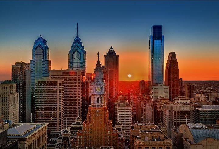
Philadelphia, PA - Philadelphia, the birthplace of American democracy, is a city where history and modernity intertwine, creating a vibrant tapestry of urban experiences. Its unique design, a blend of thoughtful planning and organic evolution, invites exploration and discovery.
Penn's Legacy: A Grid for the Ages
William Penn, the city's visionary founder, bestowed upon Philadelphia a gift that continues to shape its character: a logical grid layout in Center City. Numbered streets run north-south, intersecting with tree-named streets like Walnut, Locust, and Spruce, creating an orderly system that makes navigation intuitive. This grid, a hallmark of Penn's urban planning, fostered a sense of order and accessibility that has endured for centuries.
But Penn's influence extends beyond the grid. His vision for a "greene countrie town" is embodied in Philadelphia's five original squares: Rittenhouse, Washington, Franklin, Logan, and Center Square. These verdant oases, strategically placed throughout the city, offer respite from the urban bustle, inviting residents and visitors to relax, picnic, and connect with nature. Each square possesses its own distinct personality, from the elegant Rittenhouse Square, a hub of upscale shops and residences, to the playful Franklin Square, with its carousel, mini-golf, and interactive fountain.
The Parisian Influence: A Grand Avenue
Inspired by the Champs-Élysées, the Benjamin Franklin Parkway cuts a diagonal path through the city grid, connecting City Hall to the Philadelphia Museum of Art. This grand avenue, lined with majestic trees and impressive architecture, is a testament to the city's appreciation for art and culture.
The Parkway is home to some of Philadelphia's most iconic cultural institutions, including the Barnes Foundation, with its renowned collection of Impressionist and Post-Impressionist art; The Franklin Institute, a science museum that sparks curiosity and wonder; and the Rodin Museum, showcasing the works of the renowned French sculptor. Strolling along the Parkway is akin to taking a Parisian promenade, with art, history, and natural beauty converging at every turn.
Waterfront Renaissance: Rivers of Opportunity
Philadelphia is cradled between two rivers: the Schuylkill and the Delaware. Once industrial corridors, both waterfronts have undergone remarkable transformations, becoming vibrant hubs for recreation, entertainment, and community gathering.
The Schuylkill River Trail, a scenic path that winds along the river's edge, is a haven for walkers, runners, and cyclists. The Schuylkill Banks Boardwalk offers a unique perspective on the city, with its elevated walkway and panoramic views. On the Delaware River, Spruce Street Harbor Park has become a beloved summer destination, with its hammocks, floating gardens, and festive atmosphere. The Blue Cross RiverRink, a seasonal attraction, offers ice skating in the winter and roller skating in the summer, adding to the waterfront's dynamic energy.
Beyond Center City: A Tapestry of Neighborhoods
While Center City is the heart of Philadelphia, the city's true character lies in its diverse neighborhoods. Venture beyond the grid to discover hidden gems and unique communities, each with its own distinct personality and charm.
Explore the historic streets of Society Hill, lined with elegant Federal-style townhouses. Wander through the Italian Market in South Philadelphia, a bustling marketplace filled with the aromas of fresh produce, spices, and homemade pasta. Experience the artistic vibe of Fishtown, with its converted warehouses, vibrant murals, and trendy cafes. From the cobblestone streets of Old City to the leafy avenues of Chestnut Hill, Philadelphia's neighborhoods offer a rich tapestry of cultures, cuisines, and architectural styles.
A City in Constant Motion:
Philadelphia is a city in constant motion, where history and innovation converge. Its unique urban design, a blend of Penn's original vision and modern developments, invites exploration and discovery. Whether you're navigating the grid, strolling through green squares, or venturing along the revitalized waterfronts, Philadelphia offers a dynamic urban experience that's both captivating and inspiring. So come, wander its streets, immerse yourself in its diverse neighborhoods, and discover the magic that awaits around every corner.


